
Garmin GPS 76 Handheld GPS Navigator
4.6Editor score
WAAS enabled GPS receiver
Up to 16 hours battery life
Compact and portable design
Modern marine GPS units are essential tools for safe and efficient navigation on the water. Whether you are fishing, cruising, or sailing, having accurate positioning and detailed chart data can make a significant difference in your experience.
We have carefully evaluated ten leading marine GPS units based on display quality, mapping features, sonar compatibility, and overall ease of use. This selection includes both fixed-mount chartplotters and rugged handheld devices to cover various boating needs.
Each pick highlights key strengths and specific use cases to help you find the best match for your vessel. Please note that product availability and pricing may change over time, so verify current details before purchasing.
4.6Editor score

4.4Editor score

5.0Editor score
As an Amazon Associate we earn from qualifying purchases.
The following table provides a side-by-side overview of the top marine GPS units reviewed in this guide. Each entry lists key specifications to help you quickly compare display size, connectivity options, and included features across different models.



The Simrad GO Chartplotter and Fish Finder is a versatile device designed to enhance navigation and fishing on smaller vessels. With a rating of 4.4 stars, it offers a robust combination of GPS, sonar, and radar capabilities in one multifunction display.
We may earn a commission when you buy through this link, at no additional cost to you.
This unit includes a C-MAP Discover chart card with detailed Vector Charts and bathymetric contours. The built-in GPS and Wi-Fi allow for seamless system integration, while the HDI transducer supports clear CHIRP sonar and DownScan Imaging for identifying fish targets.
While the feature set is impressive, initial setup may require some time to configure all connectivity options properly. The display brightness is generally good but might struggle in direct sunlight compared to higher-end models.
Boaters looking for a capable all-in-one solution for sportboats or center-consoles will find this unit offers excellent value. It balances performance and affordability effectively for recreational navigation needs.
The included C-MAP card provides tides, currents, and depth shading for better route planning and safety.
Mirror your display to a smartphone or tablet to access charts and radar from anywhere on board.
We may earn a commission when you buy through this link, at no additional cost to you.
The Garmin ECHOMAP UHD2 94sv stands out for its bright, sunlight-readable touchscreen and comprehensive mapping features. It holds a strong rating of 4.7 stars among users who value clarity and ease of use during long trips.
We may earn a commission when you buy through this link, at no additional cost to you.
This chartplotter includes a GT56-TM transducer for traditional, ClearVü, and SideVü scanning sonars. Built-in Navionics+ coastal charts provide integrated data, and wireless connectivity allows you to share waypoints and routes effortlessly between devices.
While the cost is higher than entry-level units, the included hardware and software justify the investment for serious anglers. The wireless connection to Force trolling motors adds a layer of convenience that enhances navigation control on the water.
Boaters who prioritize map detail and display quality will appreciate the advanced features of this model. It is an excellent choice for those seeking a premium chartplotting experience with integrated sonar capabilities.
Traditional, ClearVü, and SideVü scanning sonars provide detailed views of fish and structure below the boat.
Wirelessly connect to your Force trolling motor to navigate to waypoints and control speed directly from the display.
We may earn a commission when you buy through this link, at no additional cost to you.
The Garmin GPS 76 Handheld GPS Navigator is an affordable and reliable option for basic positioning needs on the water. With a rating of 4.6 stars, it remains a popular choice for boaters who need essential navigation without complex features.
We may earn a commission when you buy through this link, at no additional cost to you.
This device features a WAAS enabled GPS receiver that tracks up to 12 satellites for accurate positioning. The built-in trip computer provides current and average speed, while the unit runs on standard AA batteries for up to 16 hours of use.
Although it lacks modern touchscreen capabilities and detailed charts, its simplicity is a strength for users who prefer straightforward operation. The compact design makes it easy to carry in a pocket or life vest without adding bulk.
For those on a tight budget or needing a backup navigation tool, this handheld delivers solid performance. It is best suited for coastal navigation where detailed fish-finding features are not the primary requirement.
WAAS enabled receiver continuously tracks satellites to ensure you know exactly where you are on the water.
Runs on two AA alkaline batteries providing up to 16 hours of use for extended day trips.
We may earn a commission when you buy through this link, at no additional cost to you.
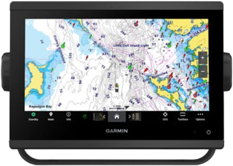
The Garmin GPSMAP 1243xsv is a high-end unit designed for larger vessels requiring extensive system integration and connectivity. While specific ratings are unavailable, its specifications point to a premium solution for advanced marine electronics systems.
We may earn a commission when you buy through this link, at no additional cost to you.
This model supports OneHelm digital switching and allows connection to third-party devices for a unified control experience. Preloaded Navionics+ charts enable immediate use, and the superior network connectivity ensures smooth communication between various onboard systems.
The inclusion of radar options like the GMR 18 HD3 Radome enhances situational awareness in varying visibility conditions. Control of the marine experience can be managed remotely, offering convenience for captains navigating large or complex vessels.
This unit is ideal for professional captains or owners who need to integrate engine data, navigation, and control systems. The investment is significant but justified for those needing top-tier network connectivity and remote management capabilities.
OneHelm digital switching allows you to connect third-party devices and control your marine system from one display.
Control your marine experience remotely for improved convenience when managing complex navigation tasks.
We may earn a commission when you buy through this link, at no additional cost to you.
The Garmin GPSMAP 79sc is a rugged handheld GPS designed to float in water and offer preloaded coastal charts for safety. With a rating of 4.0 stars, it provides reliable tracking for kayakers and small boat users who need essential navigation data.
We may earn a commission when you buy through this link, at no additional cost to you.
This unit supports multiple satellite constellations including GPS, GLONASS, and Galileo for reliable tracking worldwide. The built-in 3-axis compass and barometric altimeter enhance navigation precision, while the high-resolution color display ensures visibility in bright conditions.
Battery life extends up to 20 hours in GPS mode, making it suitable for all-day expeditions without needing frequent recharging. The water-resistant design meets IPX6 standards, offering protection against splashes and rain during wet conditions.
Boaters seeking a backup navigation tool or a primary unit for small crafts will find this device practical. The inclusion of BlueChart g3 charts adds significant value by providing detailed coastal data right out of the box.
Preloaded BlueChart g3 coastal charts provide detailed maps to help you navigate safely near shorelines.
Designed to float and resist water damage ensuring you do not lose your GPS in case of accidental drop.
We may earn a commission when you buy through this link, at no additional cost to you.
The Garmin GPSMAP 79s is a rugged handheld unit that floats and includes a worldwide basemap for general navigation. It holds a rating of 4.2 stars and is designed for users who travel to diverse locations without needing specific regional chart data.
We may earn a commission when you buy through this link, at no additional cost to you.
This model tracks using multiple satellite constellations for reliable positioning around the world. The high-resolution color display and scratch-resistant fogproof glass ensure clear visibility, while the built-in compass and altimeter support precise orientation.
Battery life remains strong at up to 20 hours in GPS mode, allowing for extended use without interruption. While the included basemap is functional, detailed coastal or lake charts may require additional purchases for serious navigation.
Travelers and international boaters who need a reliable backup device will appreciate the global coverage. It is an excellent choice for recreational use where precise chart details are secondary to basic positioning and safety.
Worldwide basemap ensures you have basic navigation data available anywhere you travel without needing regional charts.
Rugged design that floats ensures the unit remains accessible even if accidentally dropped overboard into the water.
We may earn a commission when you buy through this link, at no additional cost to you.
The Garmin GPSMAP1022XSV offers a 10-inch display for marine navigation with a focus on baseline mapping capabilities. It holds a high rating of 4.7 stars, suggesting strong user satisfaction with its interface and overall build quality for standard applications.
We may earn a commission when you buy through this link, at no additional cost to you.
This unit provides clear visual feedback for routes and waypoints, though it does not include a transducer for sonar functionality. The marine interface is standard, making it easy to integrate with other electronics via traditional connection methods.
Users needing a simple and reliable chartplotter without advanced fish-finding features will find this model effective. The large screen aids visibility, and the high rating reflects its reliability for daily navigation needs on the water.
For those who plan to add third-party sonar later or use visual navigation primarily, this unit offers a solid foundation. It balances screen size and cost effectively for small to medium-sized recreational boats.
The 10-inch screen offers ample space for viewing routes and waypoints clearly even in bright conditions.
While no transducer is included, the system supports future upgrades for sonar functionality if needed later.
We may earn a commission when you buy through this link, at no additional cost to you.
The Simrad GO Chartplotter is a versatile device designed to enhance navigation and fishing on smaller vessels. With a rating of 4.4 stars, it offers a robust combination of GPS, sonar, and radar capabilities in one multifunction display.
We may earn a commission when you buy through this link, at no additional cost to you.
This unit includes a C-MAP Discover chart card with detailed Vector Charts and bathymetric contours. The built-in GPS and Wi-Fi allow for seamless system integration, while the HDI transducer supports clear CHIRP sonar and DownScan Imaging for identifying fish targets.
While the feature set is impressive, initial setup may require some time to configure all connectivity options properly. The display brightness is generally good but might struggle in direct sunlight compared to higher-end models.
Boaters looking for a capable all-in-one solution for sportboats or center-consoles will find this unit offers excellent value. It balances performance and affordability effectively for recreational navigation needs.
The included C-MAP card provides tides, currents, and depth shading for better route planning and safety.
Mirror your display to a smartphone or tablet to access charts and radar from anywhere on board.
We may earn a commission when you buy through this link, at no additional cost to you.
The Garmin GPSMAP 1223xsv is a top-tier combo unit featuring a bright 12-inch IPS display and powerful sonar capabilities. With a perfect rating of 5.0 stars, it is widely praised for its clarity and performance in demanding marine conditions.
We may earn a commission when you buy through this link, at no additional cost to you.
This device includes built-in traditional CHIRP, ClearVü, and SideVü scanning sonars that provide detailed views of fish and structure. J1939 connectivity allows for integration with engines and other devices, while Wi-Fi and Bluetooth enable easy data sharing with smartphones.
While the investment is significant, the quality of the display and the depth of sonar imaging justify the cost for serious anglers. The optional BlueChart g3 Vision charts add even more detail for users who need precise coastal navigation data.
Boaters who demand the best in visual clarity and fish-finding performance will appreciate this unit. It is an ideal choice for those seeking a high-end solution that combines advanced navigation with exceptional imaging quality.
The 5000-watt CHIRP sonar provides excellent target separation and clarity even in deep water environments.
J1939 and NMEA networking allow connection to autopilots, radios, and other marine electronics seamlessly.
We may earn a commission when you buy through this link, at no additional cost to you.
The Garmin GPSMAP 743 is a compact chartplotter designed for users who prioritize detailed mapping and display quality. It holds a perfect 5.0 star rating, reflecting strong user satisfaction with its pre-loaded Navionics+ charts and improved optics.
We may earn a commission when you buy through this link, at no additional cost to you.
This unit features ultra high-definition scanning sonar support and Panoptix sonar compatibility for those who wish to add advanced imaging later. The 7-inch display offers a balance between visibility and fit on smaller dashboards or console spaces.
While it does not include a transducer, the pre-loaded mapping provides immediate utility for navigation tasks. The high ratings suggest that users appreciate the reliability and clear display performance this unit delivers consistently.
Boaters needing a compact yet powerful navigation tool will find this model suitable for their needs. It is an excellent option for those who value map detail and display quality over immediate built-in sonar capabilities.
Improved display optics ensure that maps and data remain clear and readable even in challenging lighting conditions.
Support for Panoptix sonar allows you to upgrade your imaging capabilities when you are ready to expand.
We may earn a commission when you buy through this link, at no additional cost to you.
Selecting the right marine GPS requires considering your specific boating needs, vessel type, and desired features. The following factors will help you narrow down the options to find a model that fits your situation.
Display size and quality determine how easily you can read charts and maps while on the water. Larger screens offer more detail but require more space, while high-brightness panels ensure visibility in direct sunlight.
Choose a screen size that fits your console and a brightness level suitable for your typical sailing conditions.
Maps and chart data are critical for safe navigation. Look for units with preloaded charts for your region, such as BlueChart or Navionics, and check if updates are available via Wi-Fi.
Prioritize models with detailed coastal charts if you frequently sail near shorelines or in complex waters.
Sonar capabilities vary significantly between models, with some including transducers and others requiring separate purchases. High-frequency sonar helps identify fish while low-frequency penetrates deeper for structure.
Ensure the unit supports the specific transducer you need or choose a combo that includes it for value.
Connectivity options like Wi-Fi, Bluetooth, and NMEA 2000 allow your GPS to communicate with other electronics. These features enable sharing data with smartphones or connecting to autopilots and engine systems.
Select units with connectivity that matches your existing marine electronics to ensure seamless system integration.
Marine environments expose equipment to water, salt, and sun, so durability is paramount. Look for rugged designs, water-resistant ratings like IPX6, and scratch-resistant glass to ensure longevity.
Opt for units built to withstand harsh conditions to avoid premature replacement due to environmental damage.
Battery life matters for handheld devices that may not have a constant power source. Some models offer up to 20 hours, while fixed units rely on boat battery systems.
Choose a handheld with sufficient battery life for your typical trip duration or a fixed unit that integrates with your boat power.
A user-friendly interface makes navigation easier, especially in stressful situations. Touchscreens are popular for their intuitiveness, but physical buttons offer reliability if screens are wet or gloved.
Test the interface style to ensure it matches your preference for quick access and reliable operation.
Budget ranges vary widely from basic handhelds to advanced chartplotters. Consider what features are truly necessary versus nice-to-haves to maximize value.
Balance the cost against the included features to ensure you pay only for what you will actually use on the water.
Always update your charts and firmware regularly to ensure you have the latest navigation data and security fixes. Most units connect via Wi-Fi or USB to download updates directly from the manufacturer.
Protect your device from prolonged direct sunlight and salt spray when not in use. Clean the screen with a soft cloth and mild soap to remove grime without damaging the display coating.
Securely mount fixed units using the provided brackets and avoid mounting near magnetic interference like speakers or motors. Ensure all cables are sealed properly to prevent water ingress into the system.
Handheld units are portable and often float in water, making them ideal for kayaking or as backups. Fixed-mount units are permanently installed on the dashboard and offer larger screens and better integration with other boat systems.
Many modern units come with preloaded base maps for free. However, detailed coastal charts often require a purchase or subscription. Always check the included content before buying to avoid hidden costs.
Handheld units typically last between 16 to 20 hours on a single charge. Fixed units rely on your boat's battery system so their runtime depends on your electrical setup and usage patterns.
Yes, GPS devices do not require internet access to function because they receive signals directly from satellites. However, downloading new charts or updates requires an internet connection at some point.
Built-in sonar adds convenience by combining navigation and fish finding in one unit. If you fish regularly, the investment is worth it. For pure navigation, a separate or optional sonar may suffice.
Look for models with high IPX ratings like IPX6 which resist water jets. Use a waterproof pouch for handhelds and seal all cable connections for fixed units to prevent moisture intrusion.
We have reviewed ten diverse marine GPS units ranging from affordable handhelds to advanced chartplotters. Each offers unique benefits tailored to different types of boaters, from casual sailors to serious anglers.
When making your choice, prioritize features that match your specific vessel and navigation needs. Consider display quality, map detail, and connectivity options to ensure a seamless experience on the water.
Prices and availability for marine electronics change frequently. Always check current product details and pricing on the linked pages before making your final purchase decision.